
MINNESOTA, USA — A spring storm system lashed out at parts of Minnesota Tuesday tipping over semis and power poles, uprooting trees and dropping hail as large as golf balls in some communities. Radar indicated at least one tornado near Spring Valley shortly after 11 p.m.
The main window for seeing the storms lasted between 7 p.m. and 12 a.m. Tuesday night into Wednesday morning. In addition to lightning and thunder, rain totals ranged between a half to three quarters of an inch.
Wednesday morning
10:30 a.m.
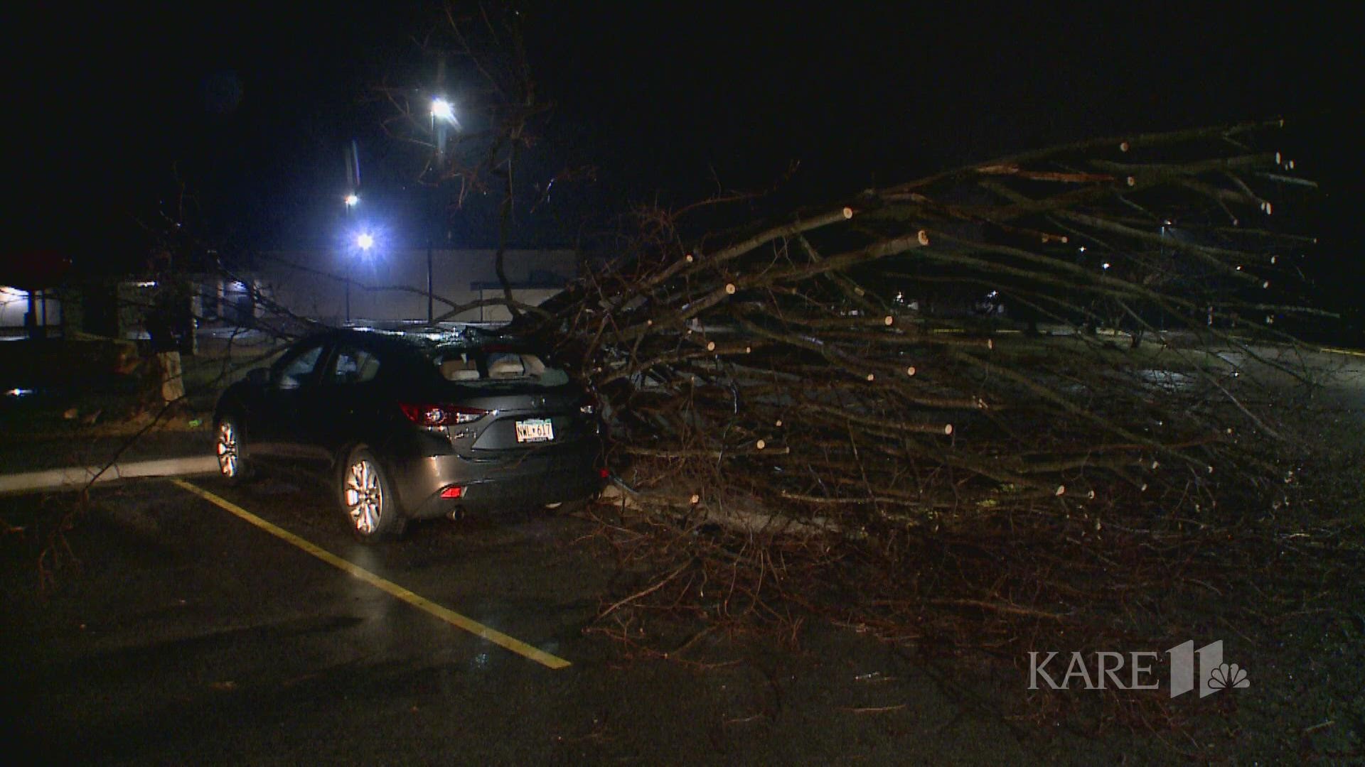
KARE 11 crews captured some of the storm damage in Faribault, Minnesota Wednesday morning, including a tree that collapsed onto a car and damaged homes.
Tuesday night
9 p.m.
KARE 11 Meteorologist Belinda Jensen said storms were moving through southwest portions of the metro, where the threat of 60 mph winds and quarter-size hail was present around 9:30 p.m.
Much of the southern metro was under a severe thunderstorm warning as of 9:40 p.m. with hail and wind warnings.
8 p.m.
KARE 11 Meteorologist Belinda Jensen says severe storms are expected to hit the metro just after 8 p.m. Meteorologist Laura Betker added several counties
Meteorologist Laura Betker added that several counties to the south, including Dodge, Fillmore, Mower and Olmsted are under a tornado watch until midnight. Meanwhile, a tornado watch for Blue Earth, Faribault, Freeborn, Martin, Steele, Waseca and Watonwan Counties is set to expire at 10 p.m.
Hoff said around 8:15 p.m., thunderstorms were moving through an area just north of Faribault. Hoff reports consistent rain, lightning and thunder, which has apparently caused dozens of truckers to take cover at a truck stop off Interstate 35W.
KARE 11 photojournalist David Peterlinz said he was also forced off the road Tuesday night, reporting pea-sized hail near Cleveland, Minnesota in LeSueur County.
About 20 minutes later Peterlinz reported power had gone out in at least one part of Le Center.
7 p.m.
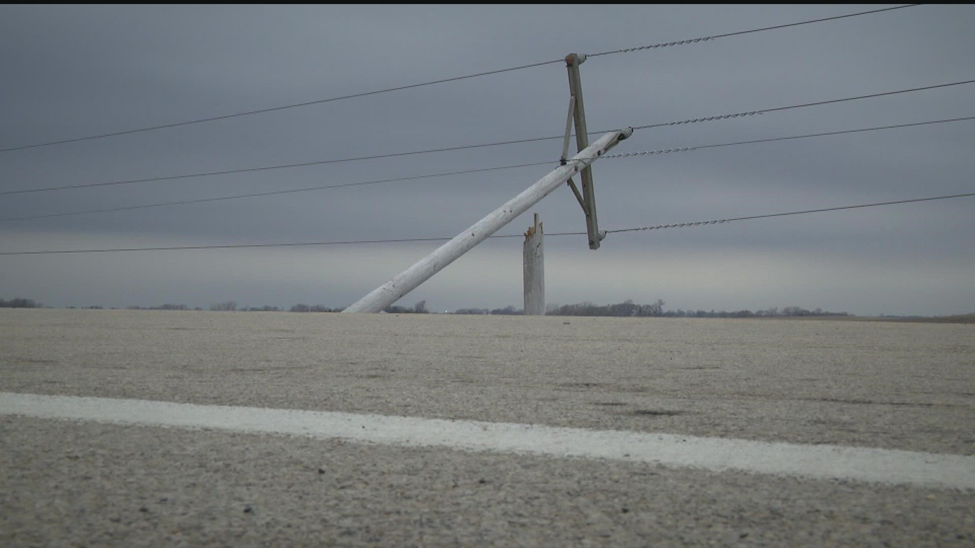
KARE 11's Jennifer Hoff was in Rice County Tuesday night, where she said strong winds damaged several farm buildings and at least eight power poles.
Hoff reports crews were working to restore power, but residents told her they don't expect to get power back until Wednesday.
Power crews reportedly halted work at the outset of the next round of storms, electing to "hunker down" until they move through.
3 p.m.
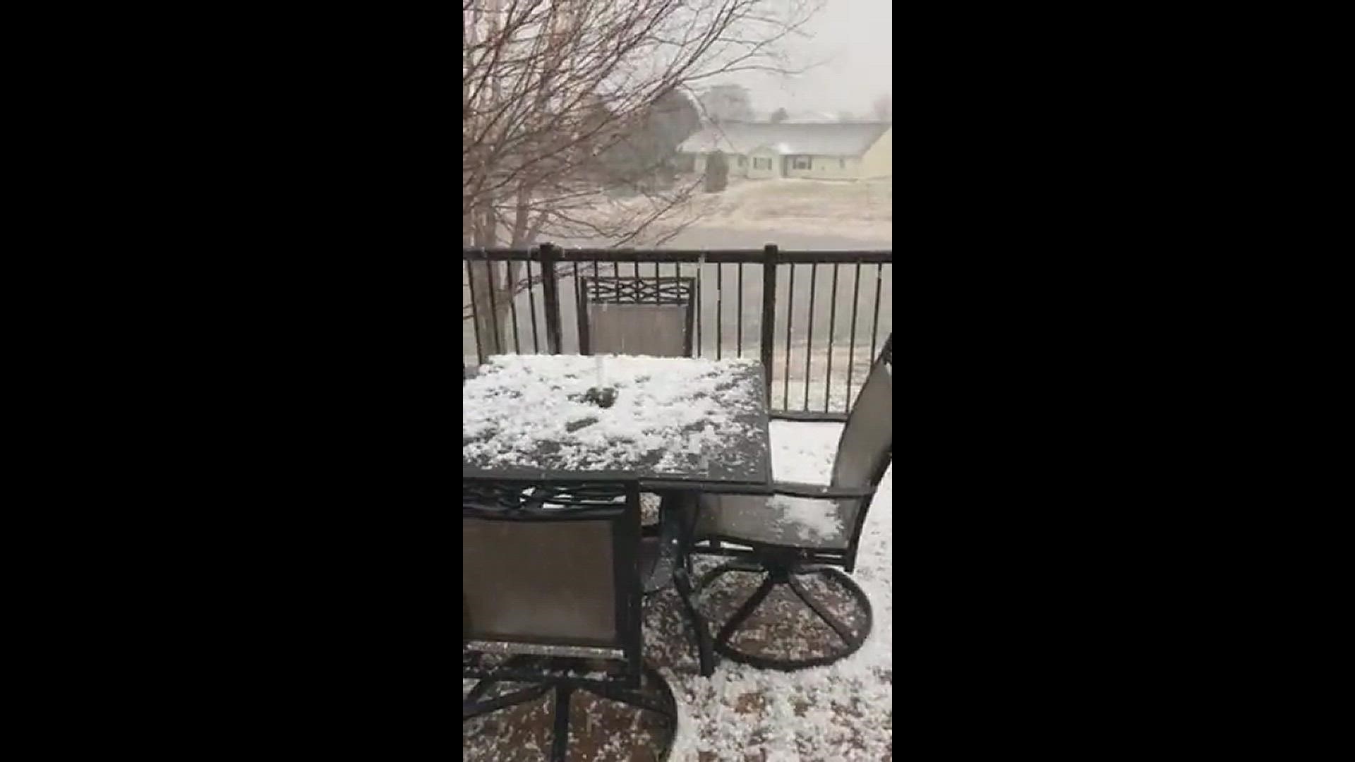
Hail-producing storms have been reported in several areas, including Northfield, Dundas and Cannon Falls.
PHOTOS: Hail-producing April storms


2:15 p.m.
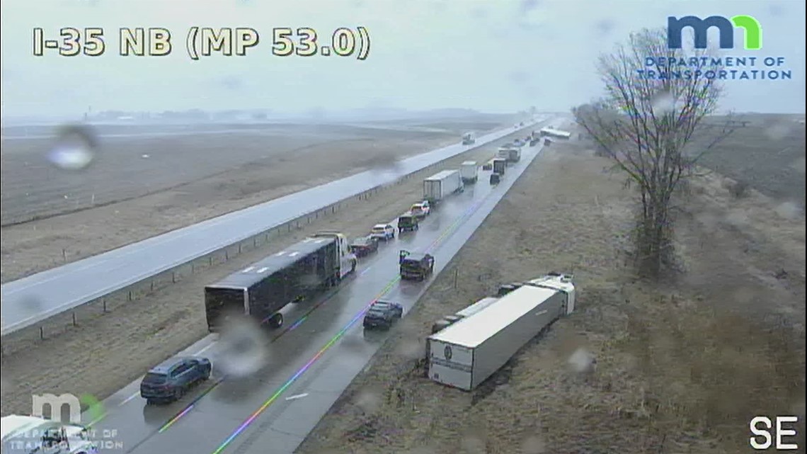
Strong winds have tipped over nine semi trucks on I-35W northbound at mile marker 55, south of Faribault. A MnDOT traffic camera captured several semis on their side. KARE 11 meteorologist Laura Betker said an airport near Owatonna recorded a wind gust up to 48 MPH, and gusts hit about 45 MPH in Faribault around 2:15 p.m., however it's possible that wind gusts in the area were stronger as the storm moved through.
Just after 3 p.m., Minnesota State Patrol confirmed no injuries were reported from any of the nine semis that tipped.

Watch more WeatherMinds content from the KARE 11 weather team on our YouTube playlist: