
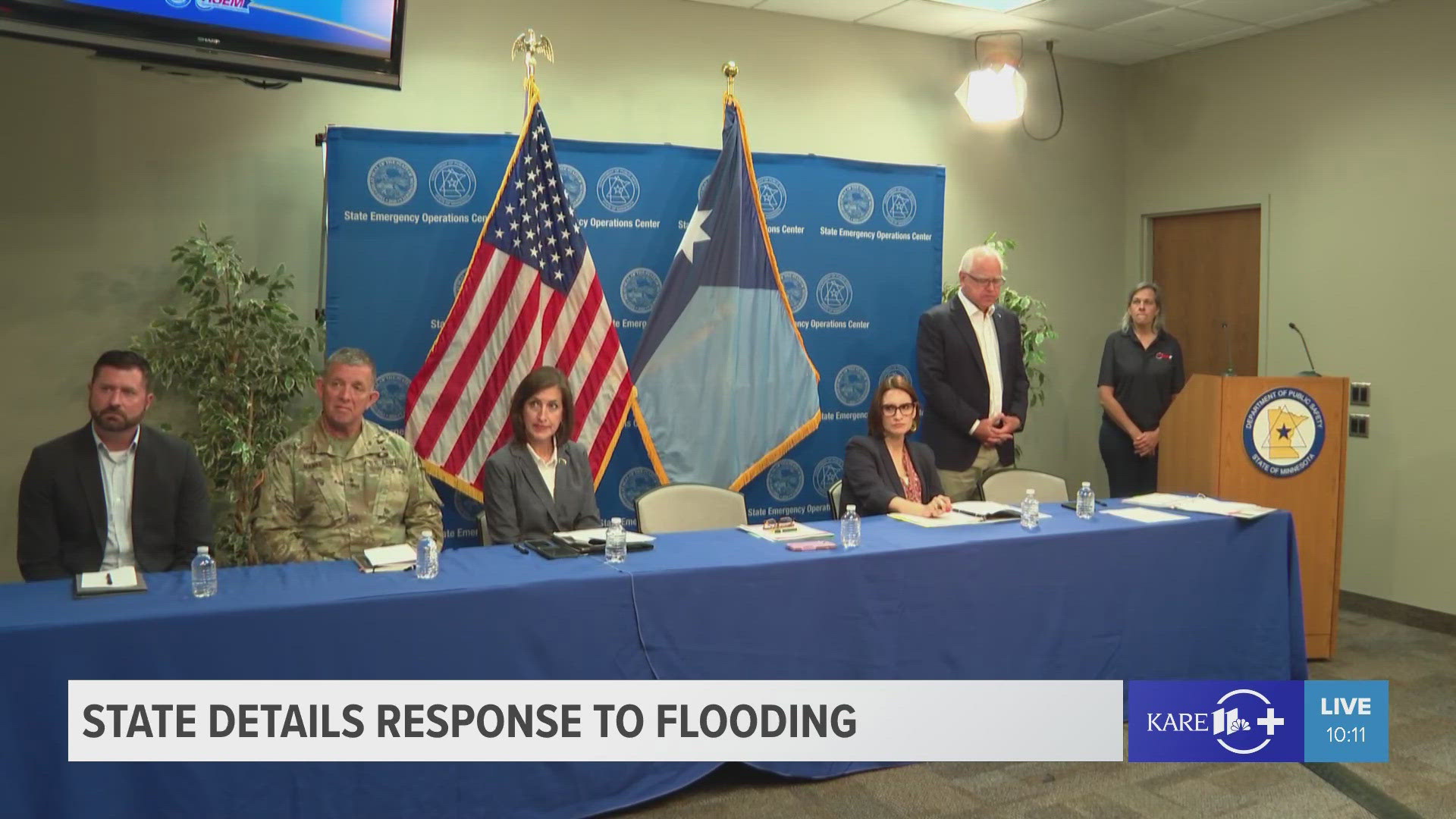
WATERVILLE, Minn — State leaders are detailing Minnesota's response to catastrophic flooding in dozens of counties after last week's torrential rain.
During a press conference Monday, Governor Tim Walz and a number of his commissioners spoke about the impact on infrastructure, public health and the state budget, also addressing concerns that the worst might not be over.
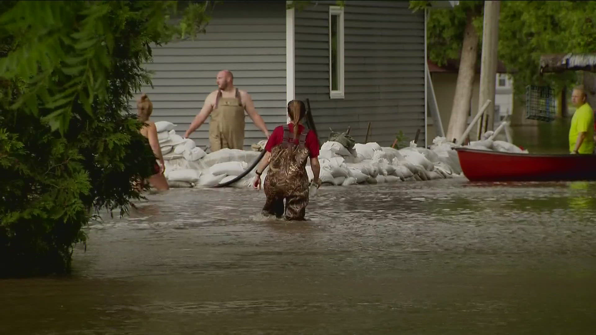
On the front burner is the community of Waterville in Le Sueur County, where residents and business owners say conditions are worsening and floodwaters continue to rise, swamping the city's main street and scores of homes and vacation properties.
Aerial footage from SKY 11 confirms what both emergency officials and those who live there are saying: this is the worst flooding event in Waterville's history. Despite a weekend of diligent sandbagging efforts, many buildings have been overwhelmed with feet of water.
"Worst thing I've ever been through," shared Brent Wilcox, owner of Cannon Gate Park, which was overcome by floodwaters along with his home. "Praying I don't fall into financial ruin and have to live in your basement."
"The flooding on Lake Tetonka is catastrophic," resident Shawn Gaines concurred in a Facebook post that reflected his current situation. Gaines told friends their cabin is surrounded by water that is three feet deep in places.
"Keep the town in your thoughts and prayers," he posted. "They're going to need a ton of support in the weeks that follow."
Maj. General Shawn Manke told reporters that 46 soldiers from the National Guard will eventually be deployed in Waterville, many of whom arrived Monday and immediately consulted with local incident commanders. Their main mission will be to staff pump stations around the clock and support emergency officials in any way possible.
Manke added that additional National Guard resources - from helicopters and high-water vehicles to engineering expertise and support - will be available to assist.
"Our soldiers and airmen live in the state of Minnesota, they work in the state of Minnesota, and most importantly, they are honored to serve the state of Minnesota," Manke said.
Roads are always a casualty of flooding and many have been covered by floodwaters, washed out or otherwise damaged in most of the 40 counties identified as being impacted by Tuesday's rains. MnDOT Commissioner Nancy Daubenberger said detailed damage assessments have already begun in the northeastern part of the state, and will start in southern Minnesota as soon as floodwaters recede.
She emphasized that conditions are changing rapidly as water levels fluctuate, and urged drivers to respect closure signs and be aware of high, fast-moving water and potential mudslides.
"When a road is closed, it is not only dangerous, but it is illegal to be traveling in those areas," Daubenberger said. "Motorists can be fined, but if travelers need to be rescued from a closed road, other expenses and penalties could apply."
Paying for damage to roads, buildings and infrastructure will be a multi-level operation. Gov. Walz said that of the 40 counties currently impacting by flooding, seven have already applied for assistance.
The governor said a special disaster contingency account managed by the state currently sits at $26.4 million, with another $50 million funneling in August. Additionally, communities that hit a financial threshold for damage will be eligible for federal assistance.
"Many of you are doing the math in your head... it doesn't take much to hit those numbers anymore," Walz said.
National Weather Service Meteorologist-in-Charge Dan Hawblitzel warned that forecasters are watching closely for the potential of severe weather Monday evening that could bring damaging winds and worse, additional rain - perhaps an inch or more in some areas. In the short term, it appears we will have a dry period mid-week but over the longer haul, Hawblitzel said our wet pattern could continue due to the heat dome that is delivering scorching temps to the east coast.
The possibility of storms and severe weather looms throughout Monday and Tuesday morning, making a terrible situation potentially worse. A Flood Warning is currently in effect until 10 a.m. Tuesday in Le Sueur, Rice, Steele and Waseca Counties.
If you're driving in these areas heed warnings of closed roads, particularly in urban areas as water may take several hours to work through drainage systems. KARE 11 will have crews in Waterville Monday to provide the latest developments and more on how you can help.
WATCH MORE ON KARE 11+
Download the free KARE 11+ app for Roku, Fire TV, Apple TV and other smart TV platforms to watch more from KARE 11 anytime! The KARE 11+ app includes live streams of all of KARE 11's newscasts. You'll also find on-demand replays of newscasts; the latest from KARE 11 Investigates, Breaking the News and the Land of 10,000 Stories; exclusive programs like Verify and HeartThreads; and Minnesota sports talk from our partners at Locked On Minnesota.
- Add KARE 11+ on Roku here or by searching for KARE 11 in the Roku Channel Store.
- Add KARE 11+ on Fire TV here or by searching for KARE 11 in the Amazon App Store.
- Learn more about the KARE 11+ app for Apple TV in the Apple App Store.
- Learn more about KARE 11+ here.
Watch more local news:
Watch the latest local news from the Twin Cities and across Minnesota in our YouTube playlist: