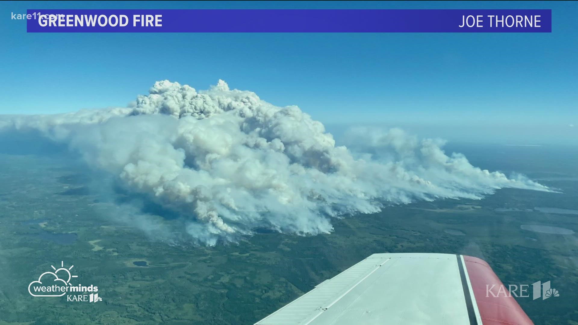
ISABELLA, Minn. — The expanding Greenwood Fire is impacting thousands of acres across the landscape of northeastern Minnesota.
But in truth, it's making a mark on the atmosphere above as well.
On Tuesday, the most volatile day of fire behavior so far, the wildfire doubled in size and increased in intensity, creating a unique weather phenomena that could be seen for miles.
Joe Thorne shared an amazing image with KARE 11 that captures a Pyrocumulus cloud formed above the fire zone. Meteorologist Ben Dery says it's far more than just a bunch of smoke... A Pyrocumulus cloud, also referred to as a fire cloud, is formed when a wildfire creates:
- a lot of heat
- atmospheric instability
- small amounts of moisture in the air
Ben explains that as a fire grows in size and intensity smoke and heat rise into the sky, and aided by instability and a bit of moisture from the air they condense and form a cloud.
A Pyrocumulus cloud is actually a small weather system that can produce lightning and even rain.

