
ST PAUL, Minn. — Floodwater is starting to recede in parts of southern Minnesota, signaling that local, state and federal officials are transitioning from emergency response to the assessment and recovery phase.
Gov. Tim Walz was joined Friday morning by officials from FEMA, the National Weather Service and members of his cabinet to update the current situation and what will be happening moving forward as Minnesota documents the damage to homes and businesses caused by rivers, streams and lakes swollen by heavy rains.
Here is an abbreviated look at what was said.
Gov. Walz
The governor noted that the last few days have provided a reprieve from the nearly constant rain of the past couple of weeks, and said that when all is said and done the events of spring 2024 will likely mark "A top 10 flood event" in Minnesota history. He noted that recovery is moving from north - where damage was largely caused by a single, catastrophic rain event - to the south, where communities were battered by rivers that collected rain over days and then swamped communities. "We will rebuild," he vowed.
Tom Sivart - FEMA
Sivart, the regional administrator for the Federal Emergency Management Agency, reminded Minnesotans that recovery from floods is a "long process," but said teams from his agency will arrive in flood-impacted communities to visit homes and businesses over the next several weeks. He emphasized that documentation of damage is essential - "Pictures are worth a thousand words to us," he emphasized - adding that it is also important to keep receipts spent on clearing and repairs.
Dan Hawblitzel - NWS Meteorologist in Charge
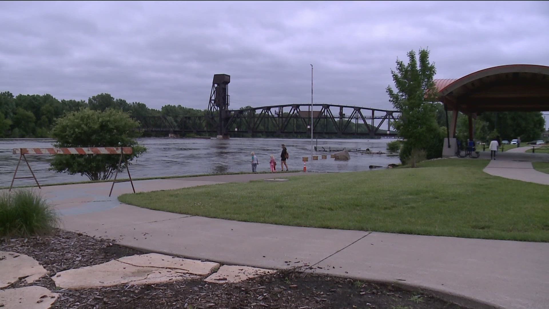
Downpours Monday morning likely fueled some anxiety, Hawblitzel acknowledged, but assured Minnesotans that the rain that fell would not add significantly to flooding woes but may perhaps prolong the process. Hawblitzel noted that the Minnesota River rose to a record high in the city of Henderson Wednesday and tied a record in Jordan. That water is flowing into the Mississippi River, which will reach its crest in downtown St. Paul on Saturday at nearly 21 feet, the seventh-highest in history. Hastings will also see major flooding in the coming days.
Hawbitzel said this weekend will bring dry conditions, allowing floodwaters to further recede before the next system brings rain Monday into Tuesday. Currently, forecasters are looking at 1-to-2 inches of rain for areas of southern Minnesota, but if the heart of the system moves north out of Iowa there could be more, which could rekindle flooding problems.
Nancy Daubenberger, MnDOT Commissioner
Daubenberger said many major roads that were closed by flooding are now reopening after being inspected by MnDOT, county and local crews. Among the roads in the southeast are Highway 169 (except for the stretch between Le Sueur and Mankato) plus Highways 15, 30, 75 and others. She reminded drivers to honor closures and said crews will continue to evaluate roads that have been swamped by floodwaters so motorists stay safe. "Our work is not done," she insisted.
WATCH MORE ON KARE 11+
Download the free KARE 11+ app for Roku, Fire TV, Apple TV and other smart TV platforms to watch more from KARE 11 anytime! The KARE 11+ app includes live streams of all of KARE 11's newscasts. You'll also find on-demand replays of newscasts; the latest from KARE 11 Investigates, Breaking the News and the Land of 10,000 Stories; exclusive programs like Verify and HeartThreads; and Minnesota sports talk from our partners at Locked On Minnesota.
- Add KARE 11+ on Roku here or by searching for KARE 11 in the Roku Channel Store.
- Add KARE 11+ on Fire TV here or by searching for KARE 11 in the Amazon App Store.
- Learn more about the KARE 11+ app for Apple TV in the Apple App Store.
- Learn more about KARE 11+ here.
Watch more WeatherMinds:
Watch the latest deep-dives and explainers on weather and science in our YouTube playlist: