
GOLDEN VALLEY, Minn. — There are some surprises that are always welcome... say, a great gift at Christmas, or an old friend dropping in at your place unannounced.
Others are not quite as welcome, like the powerful storm that hammered the Twin Cities Friday morning with a deluge of rain, powerful winds, lightning and thunder.
Based on forecast models our weather team here at KARE 11 on Thursday night predicted a couple of showers popping up around sunrise. Those who were shaken out of bed by booming thunder, or had to navigate blinding downpours on the drive to work would almost certainly tell you the morning forecast was, shall we say, a bit off.
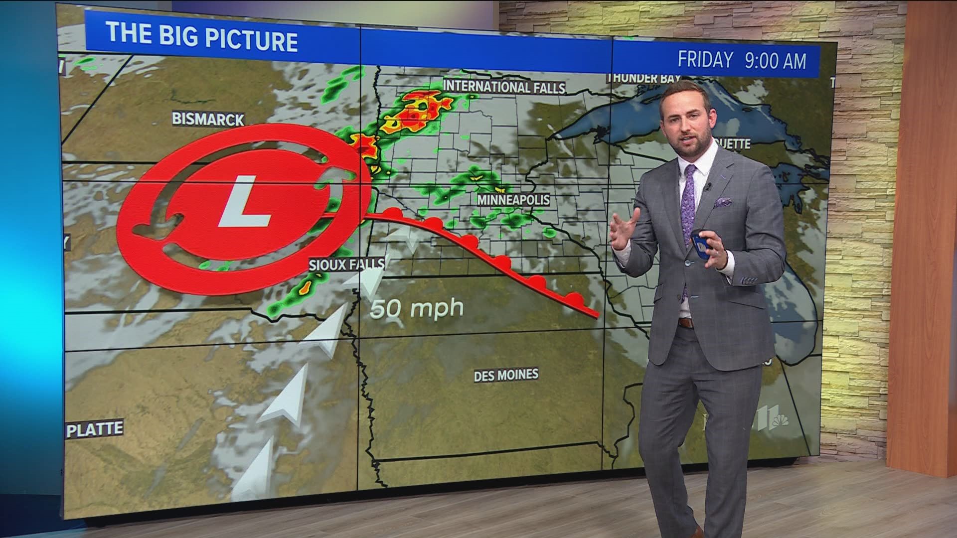
So why the discrepancy? Blame it on an unexpectedly speedy low-level jet. No, we're not talking about a plane here, we're talking about a fast-moving ribbon of air low in the atmosphere (only a few thousand feet above ground level) that transports moisture and warmer temperatures from the Gulf northward. KARE 11 meteorologist Ben Dery defines a low-level jet as "a rapid source of heat and moisture that initiates and fuels thunderstorms."
Dery went on to call this morning's low-level jet "overachieving"
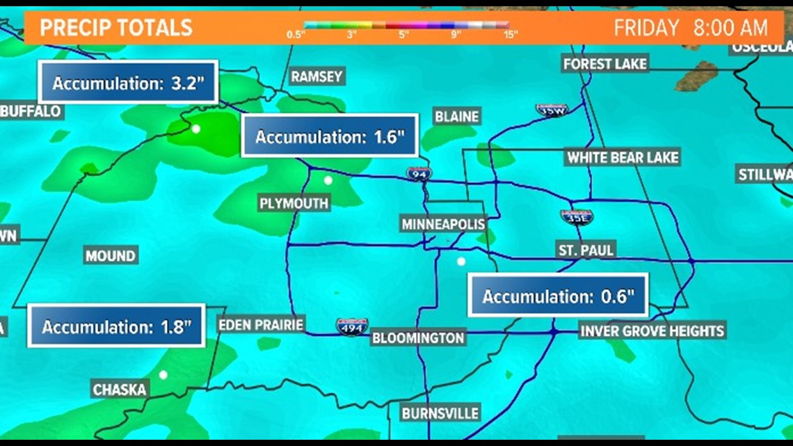
Those storms came fast and furious, dropping buckets of rain on locations like St. Michael where measurements indicate 3.2 inches of rain fell by approximately 8 a.m. In the Chanhassen area, rain totals were just under 2 inches.

"While it (the low-level jet) was not the only reason we saw storms last night, it certainly was a contributing factor," Dery explained.
Sunrise meteorologist John Zeigler says low-level jets develop at night and are frequently missed by forecast models. He says the one that blew in Friday morning quickly increased from 40 to 50 miles per hour, strengthening the storms that erupted.
WATCH MORE ON KARE 11+
Download the free KARE 11+ app for Roku, Fire TV, Apple TV and other smart TV platforms to watch more from KARE 11 anytime! The KARE 11+ app includes live streams of all of KARE 11's newscasts. You'll also find on-demand replays of newscasts; the latest from KARE 11 Investigates, Breaking the News and the Land of 10,000 Stories; exclusive programs like Verify and HeartThreads; and Minnesota sports talk from our partners at Locked On Minnesota.
- Add KARE 11+ on Roku here or by searching for KARE 11 in the Roku Channel Store.
- Add KARE 11+ on Fire TV here or by searching for KARE 11 in the Amazon App Store.
- Learn more about the KARE 11+ app for Apple TV in the Apple App Store.
- Learn more about KARE 11+ here.
Watch more WeatherMinds:
Watch the latest deep-dives and explainers on weather and science in our YouTube playlist: