
MELROSE, Minn. — Strong storms struck the community of Melrose especially hard and the National Weather Service reports a tornado touched down near the interstate on Saturday evening.
The NWS issued Severe Thunderstorm Warnings for the area on Saturday as wind and hail moved in.
According to the NWS on Sunday morning, a trained spotter reported a tornado touching down near I-94 in Melrose. It was on the ground for around four minutes, officials said. An official with the NWS said this part of the state received the worst damage in Saturday's storms. NWS confirmed it was an EF1 tornado with maximum winds of 95 mph.
Melrose is located about an hour and a half northwest of the Twin Cities.
"Unbelievable, pretty much. But it only lasted like two minutes," said Doris Frieler of Melrose.
Frieler was outside on her patio Saturday night when the storm rolled in.
"I went in the house and it was pouring just torrential rains. My husband was in the basement so I hollered to him to check it out. By the time he came up, it was over," Frieler said.
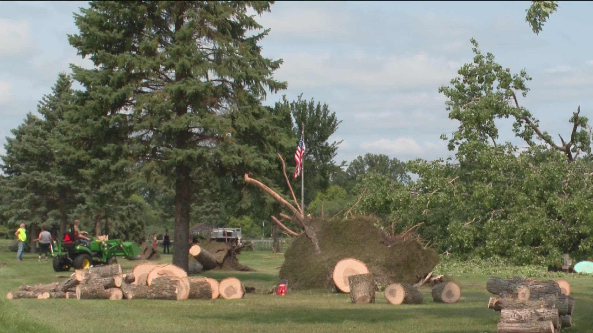
Family members came out to Frieler's home on Sunday to help clean up the downed trees. A pavilion was also taken down by the storm.
"Buildings can be replaced. Trees can be replanted. I'm just thankful that there's been no injuries reported, so far," said Tom Budde, the Melrose Fire chief.
According to Budde, the storms and tornado leveled a turkey barn full of turkeys and destroyed a storage shed with three tractors inside. It also destroyed a Melrose Metalworks building and took out more than 140 trees at Meadowlark Country Club. Some townhomes and a house were also damaged.
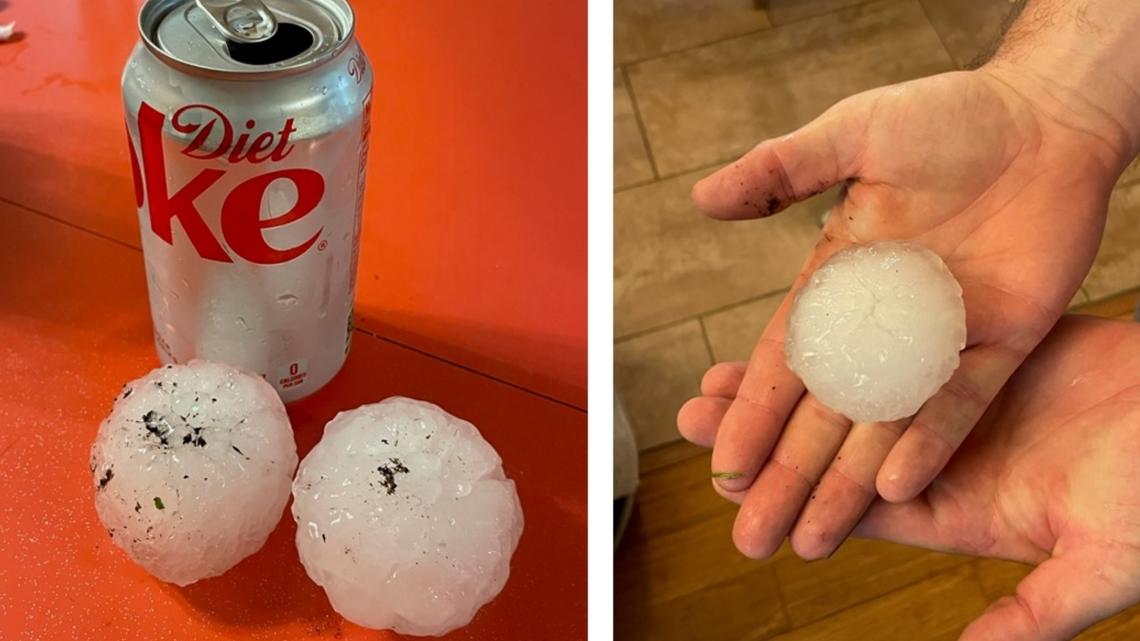
Officials with the NWS also reported hail up to three inches in diameter fell on Saturday night in Todd County. Officials said no injuries or deaths were reported.
A KARE 11 viewer Marney Olson in Wadena, located around 40 minutes north of Todd County, sent in these two images of hail the width of a soda can.

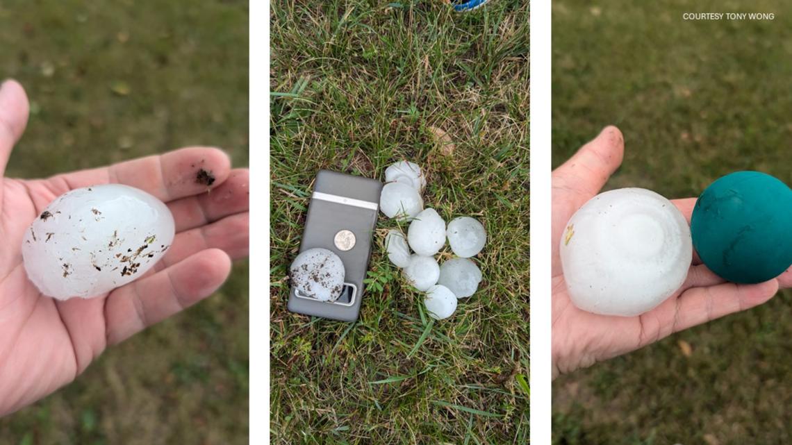
On Facebook, viewer Tony Wong shared pictures of hailstones from Wadena the size of a racquetball.

Closer to the Twin Cities, lightning and thunder were the stars of the storm.