

NORFOLK, Va. —
Hurricane Beryl
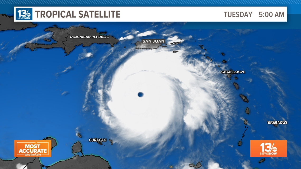
Hurricane Beryl is now a Category 5 hurricane with winds of 160 mph, becoming the earliest Category 5 hurricane on record. In addition, Beryl is now tied with the strongest July hurricane, matching Hurricane Emily in 2005.

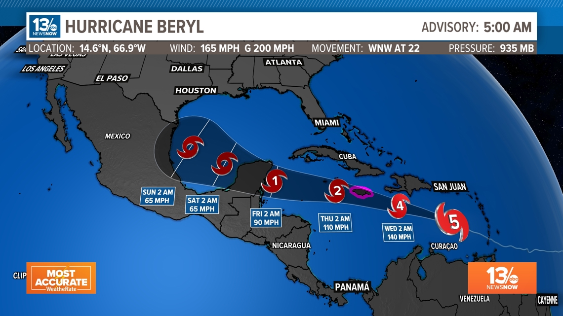
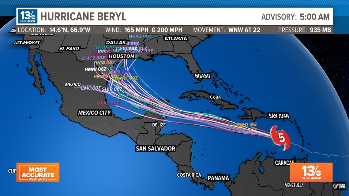
Beryl made landfall on Carriacou Island at 11:10 AM. The forecast track calls for Beryl to continue on a west-northwest path for the next several days. An increase in mid-level westerly shear is forecast by midweek, and this should cause some weakening while Beryl moves across the central and northwestern Caribbean Sea. However, Beryl is still forecast to remain a hurricane as it approaches the Yucatan Peninsula.

Models suggest Hurricane Beryl will continue on a west-northwestward track through the Caribbean and impact Jamaica Wednesday, the Cayman Islands after that, and possibly the Yucatan Peninsula later this week. An increase in mid-level westerly shear is forecast by midweek, and this should cause some weakening while Beryl moves across the central and northwestern Caribbean Sea.

Invest 96-L
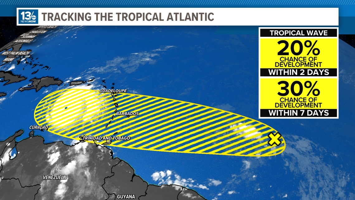
There is less confidence that a tropical wave moving through the central tropical Atlantic will become our next named storms. Chances have gone from 40% down to 30% over the next seven days.
An area of low pressure continues to produce disorganized showers and thunderstorms. Conditions only appear less conducive for additional development of this system, but a tropical depression could still form during the next few days while it moves generally westward at 15 to 20 mph across the central and western tropical Atlantic.

We are keeping close tabs on all the developments in the tropics, so continue to check back with us on 13News Now for updates.