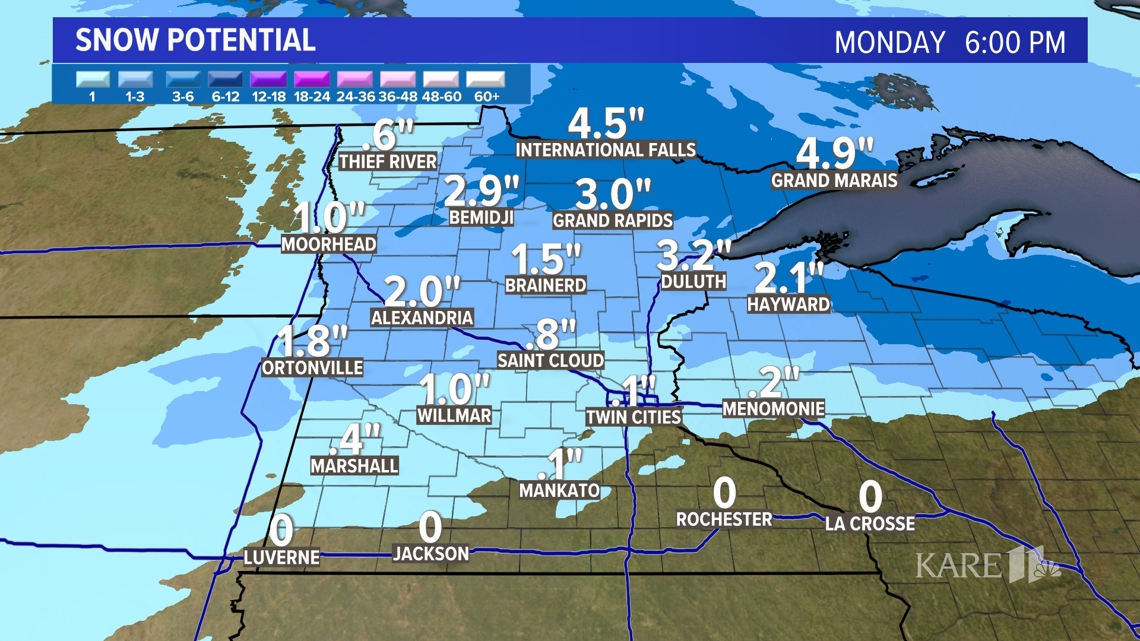
MINNESOTA, USA — Light snow fell last night across the region leaving the area with a few slick spots this morning. Side roads were packed with snow early though main roads are improving quickly.

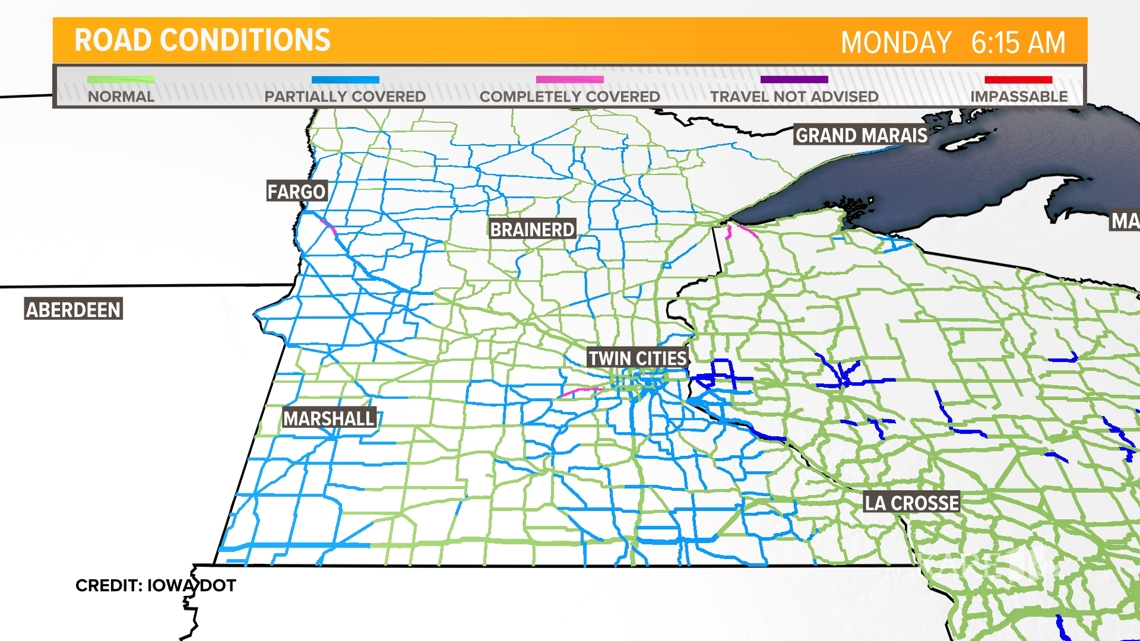
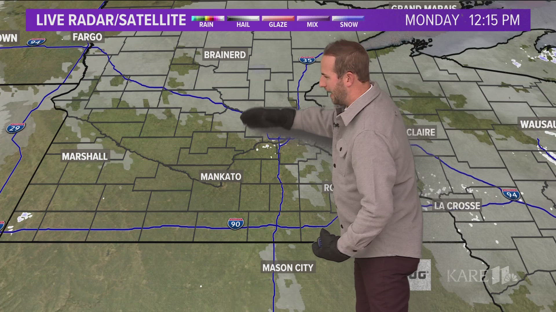
Snow showers have already weakened to flurries and that trend will continue throughout the day. Roads will improve quickly this morning.

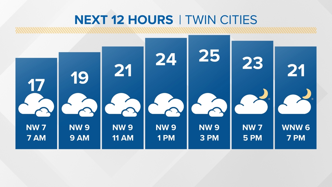
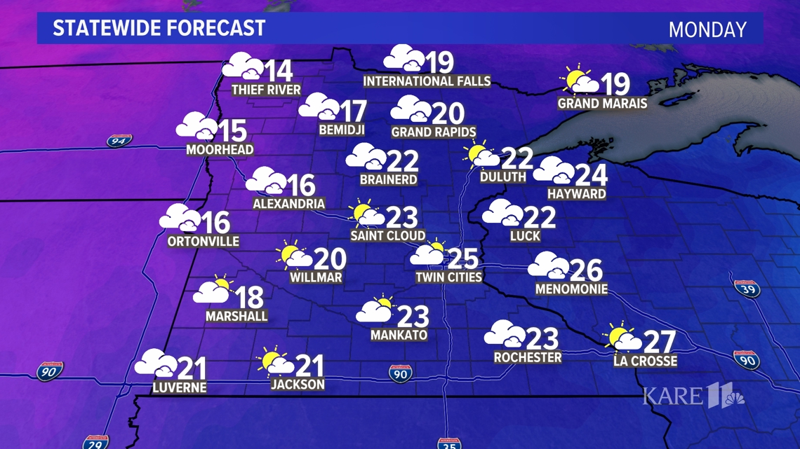
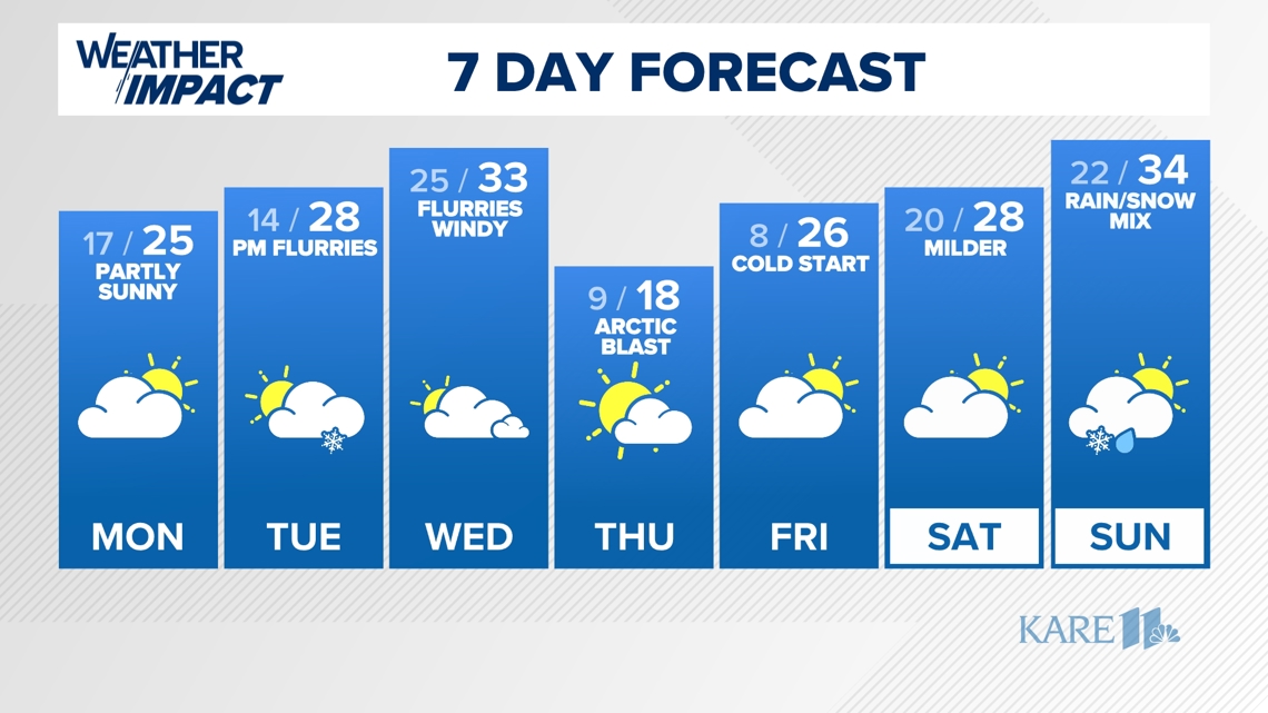
Overall, Monday is a quiet day across the state with highs in the middle 20s. Expect a few peeks of sunshine with isolated flurries possible during the morning hours.

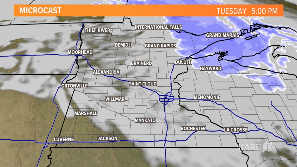
There will be a better chance of accumulating snow on Tuesday for parts of northern Minnesota, the Arrowhead region and northern Wisconsin, but we may see some light snow or flurries closer to the Twin Cities metro area.

We'll have some of our mildest temperatures of the week Wednesday morning before the next Arctic air mass arrives with strong northwest winds.
Milder temperatures next weekend are coming along with a chance of rain and snow showers around the region. There is still some uncertainty about where we'll see rain versus snow.

Text your weather-related photos or videos to 763-797-7215. While you're at it, save KARE 11 as a contact on your phone!
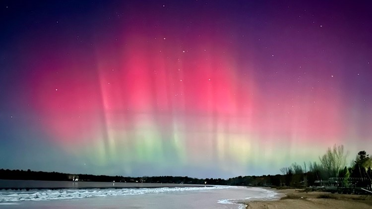
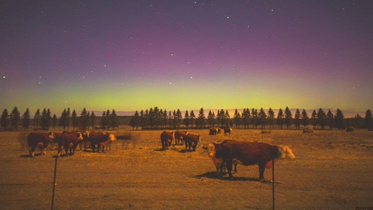
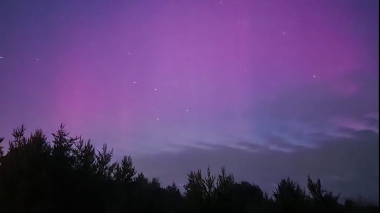
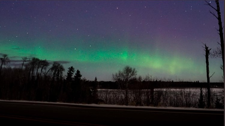
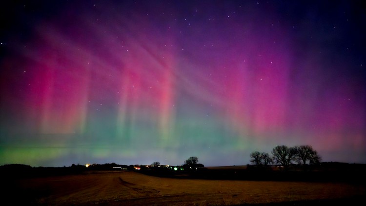
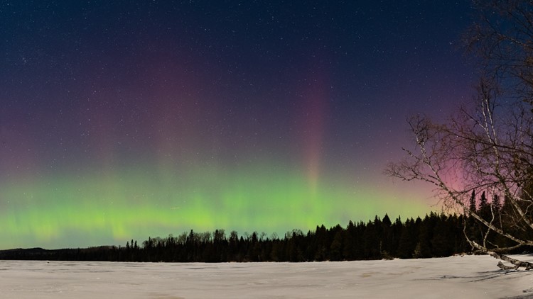
Northern lights dance across Minnesota, Wisconsin


WATCH MORE ON KARE 11+
Download the free KARE 11+ app for Roku, Fire TV, Apple TV and other smart TV platforms to watch more from KARE 11 anytime! The KARE 11+ app includes live streams of all of KARE 11's newscasts. You'll also find on-demand replays of newscasts; the latest from KARE 11 Investigates, Breaking the News and the Land of 10,000 Stories; exclusive programs like Verify and HeartThreads; and Minnesota sports talk from our partners at Locked On Minnesota.
- Add KARE 11+ on Roku here or by searching for KARE 11 in the Roku Channel Store.
- Add KARE 11+ on Fire TV here or by searching for KARE 11 in the Amazon App Store.
- Learn more about the KARE 11+ app for Apple TV in the Apple App Store.
- Learn more about KARE 11+ here.
Watch more WeatherMinds:
Watch the latest deep dives and explainers on weather and science in our YouTube playlist: